
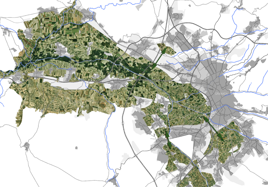

Location · Vega de Granada [Several Municipalities]
Client · Junta de Andalucía, Consejería Obras Públicas y Vivienda
Date · 2010 · 2011
Phase · Initial Proposal · Avance
Type · Special Plan · Plan Especial
Surface · 18.294 Ha
Architecture and Urban Planning · GR Arquitectos · Member of Team as Landscaper: Mathieu Lèbre
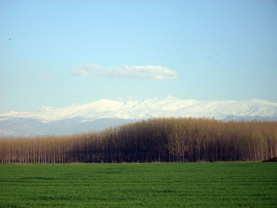
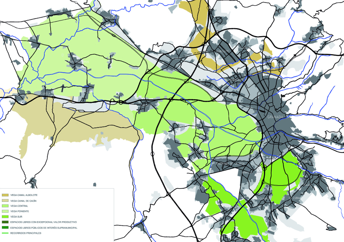
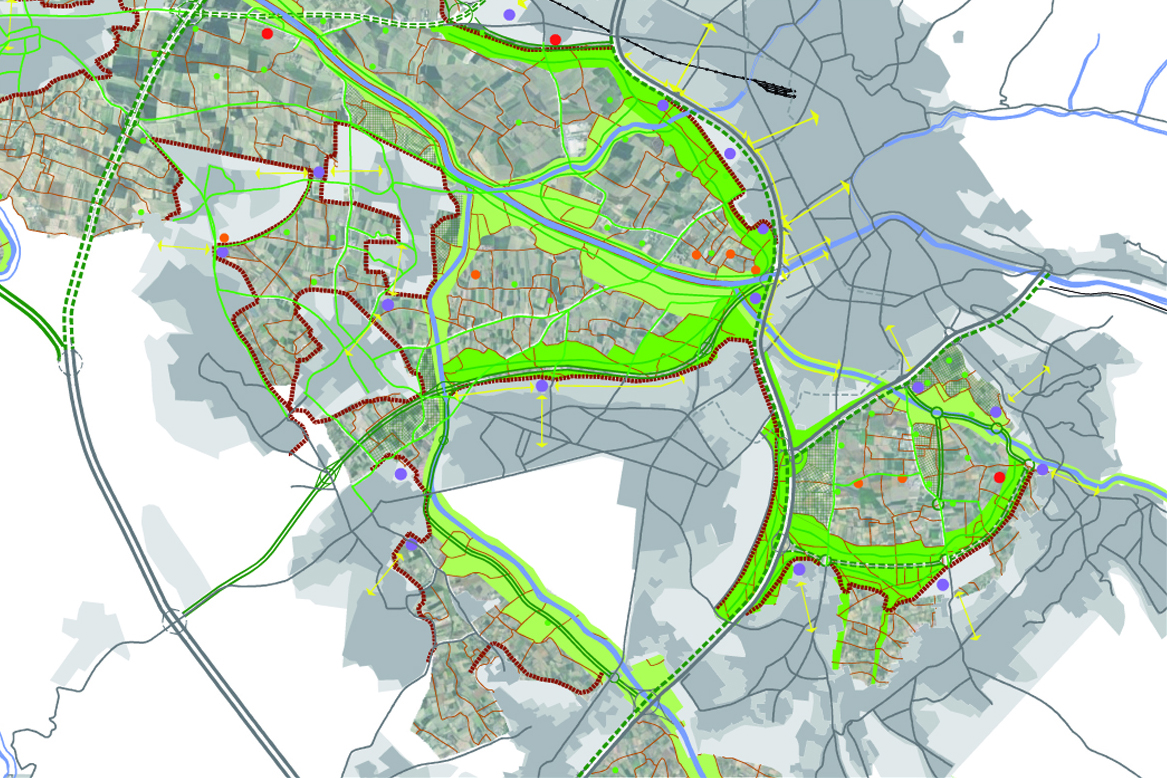
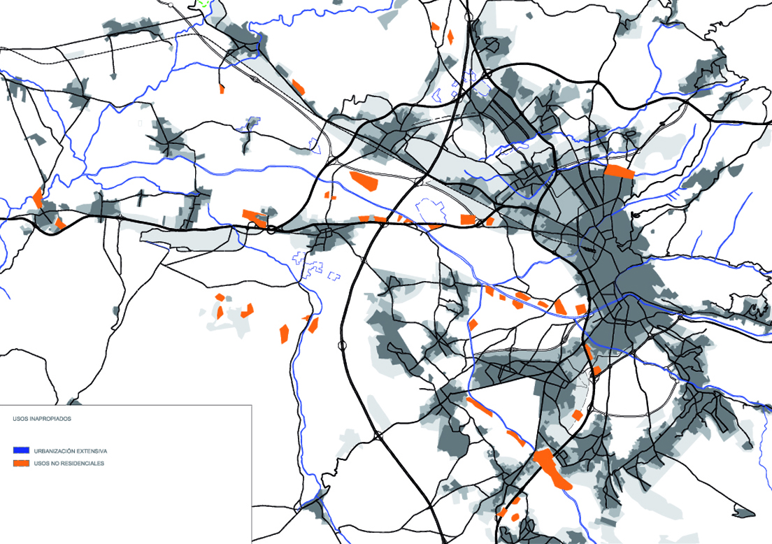
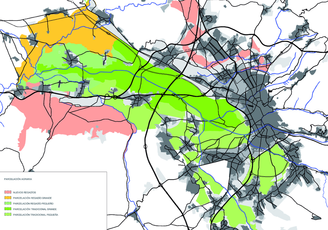
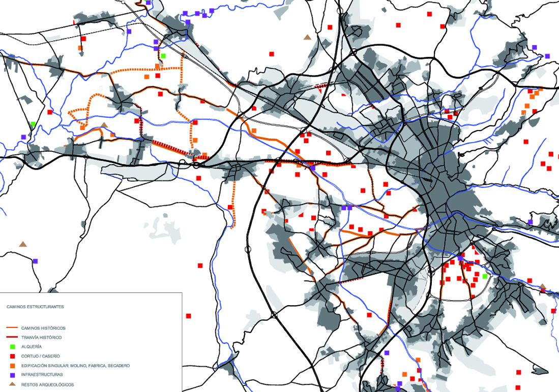
The project deals with a diagnosis and proposals on urban planning, infrastructure and the landscape of the Granada plain.
The organization of the Vega space is proposed:
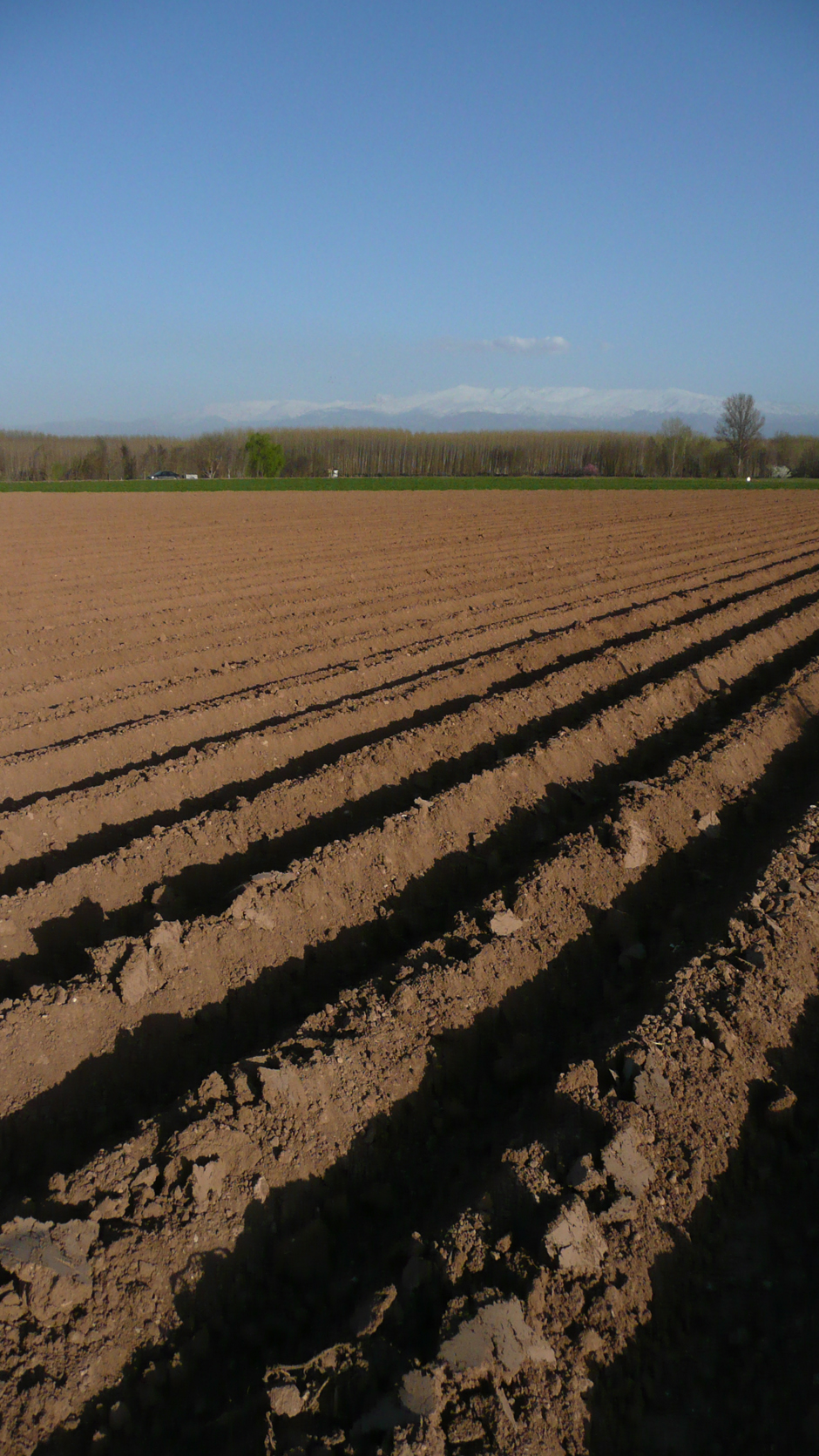
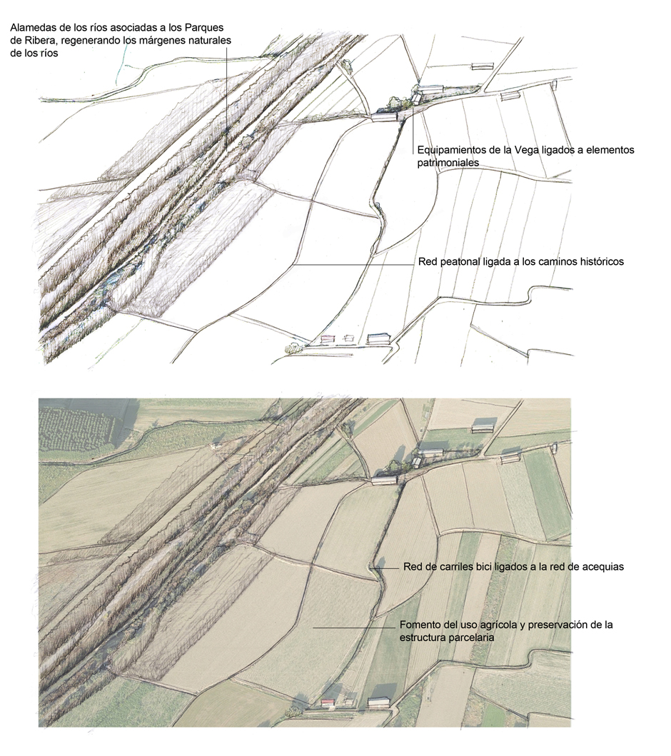
- Creating a continuous system of public free spaces that are fully connected and accessible, seeking relationships with the landscape and allowing the identity of La Vega to be discovered, taking into account its productive value.
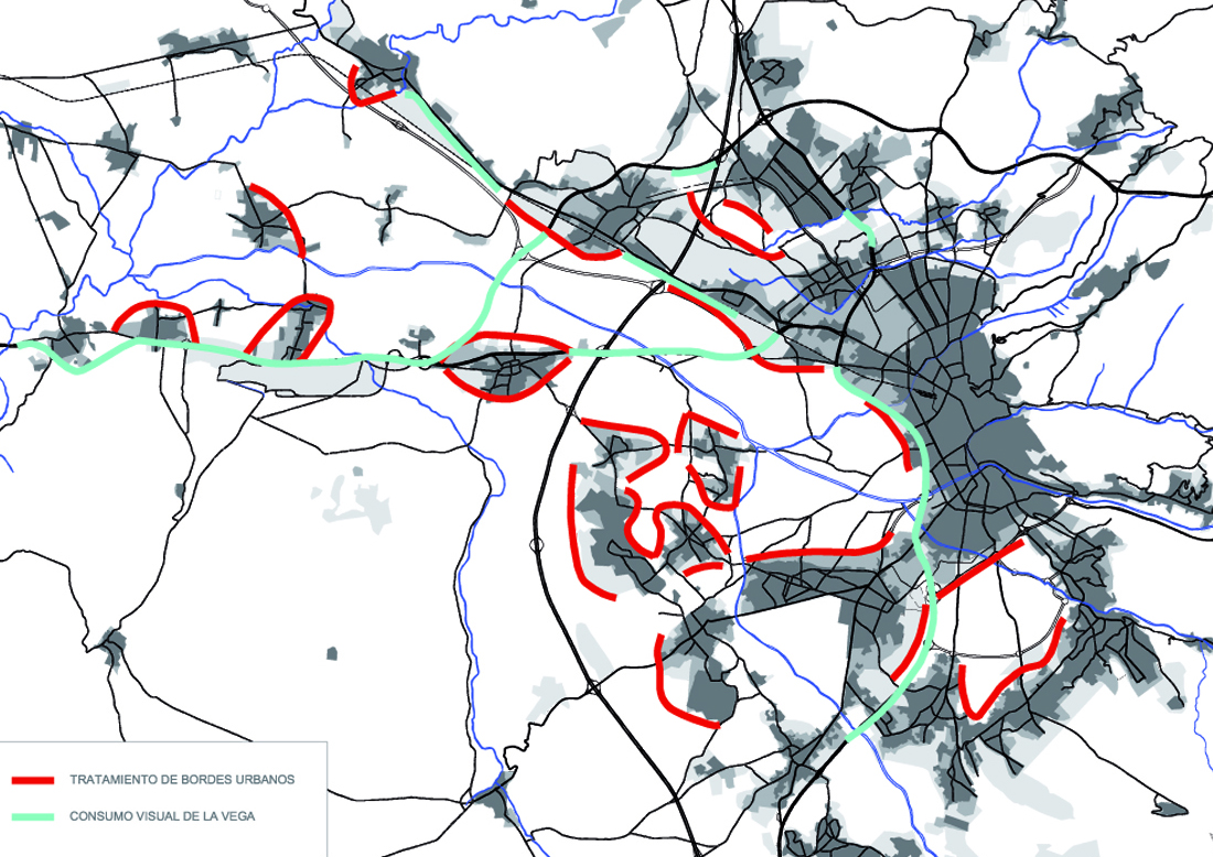
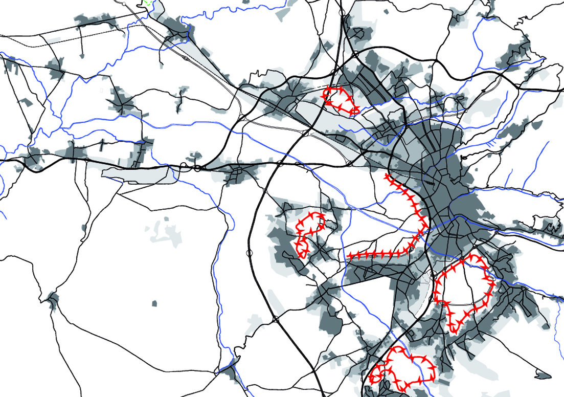
- Promoting the relationship between the different free spaces through green routes, which requires a study of the settlement system in order to establish criteria for the development of its urban edges.
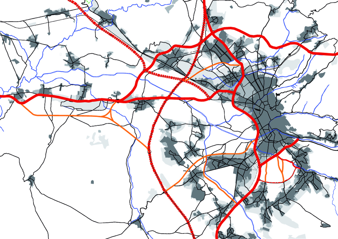
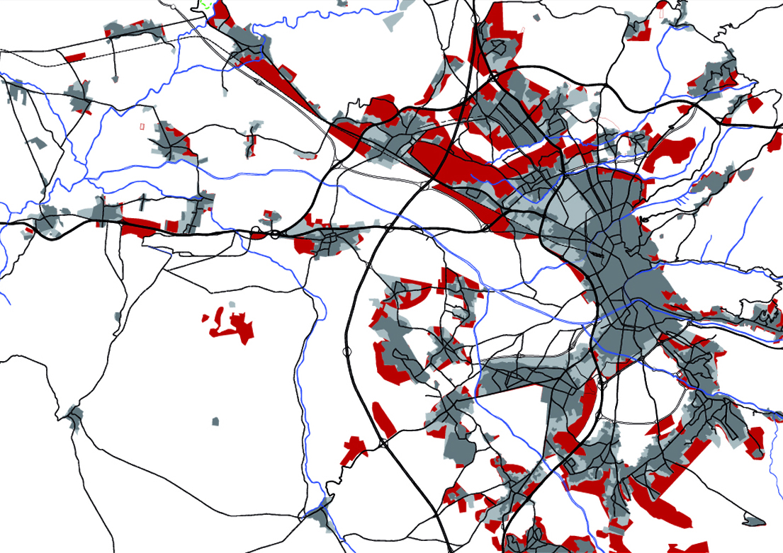
- Organizing and prioritizing the existing road network based on the new uses to be developed in La Vega, avoiding the new construction of roads that will only further fragment the territory.
- Promoting public transportation systems associated with existing articulating elements such as roads, or integrated into the system of public free spaces, or even enabling existing historic paths.
- Including public use in La Vega through the creation of routes associated with the existing road network, or, locally, through the location of equipment.
El proyecto trata de un diagnóstico y propuestas sobre el urbanismo, las infraestructuras y el paisaje de la vega granadina.
La ordenación del espacio de la Vega se plantea:
- Creando un sistema continuo de espacios libres públicos totalmente conectado y accesible buscando las relaciones con el paisaje y que permitan descubrir la identidad de la Vega teniendo en cuenta su valor productivo
- Fomentando la relación entre los distintos espacios libres mediante recorridos verdes, lo que requiere un estudio del sistema de asentamientos con el fin de poder establecer criterios para el desarrollo de sus bordes urbanos.
- Ordenando y jerarquizando la red viaria existente en función de los nuevos usos a desarrollar en la Vega, evitando la nueva construcción de carreteras que no harán más que fragmentar más aún el territorio.
- Potenciando sistemas de trasporte público asociado a elementos articuladores existentes tales como carreteras, o integrado en el sistema de espacios libres públicos o bien, o incluso habilitando caminos históricos existentes.
- Incluyendo un uso público en la Vega mediante la creación de recorridos asociados a la red de caminos existentes, o bien, de manera local, mediante la localización de equipamientos.
